Witcombe map
.
Home > Results > Witcome > Maps
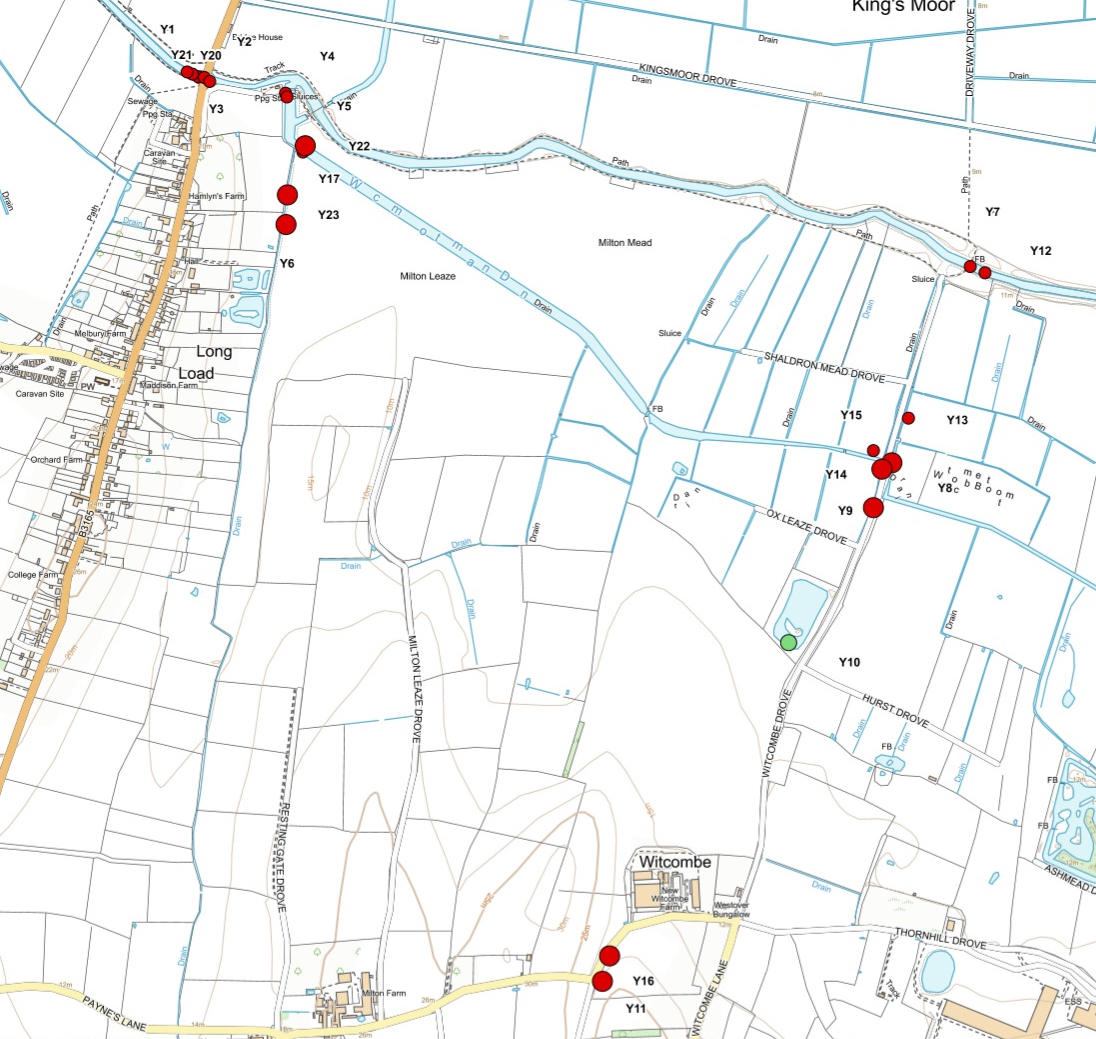
Witcombe bottom map This area is within Ash Parish and drains into the river Yeo. It is included in the survey as the great majority of the farms in both parishes sustain the large dairy at Witcombe by producing crops for the herd, in many cases by direct leasing. This in effect makes the two parishes a single environmental unit This is an area that is heavily contaiminated by phophate; all the samples except one (an interesting exception discussed below) are either Poor or Bad |
|
||||
|---|---|---|---|---|---|
|
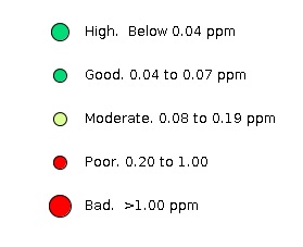
Map Legend
Data |
||||
The River Yeo Ilchester Sewage Treament Works Witcombe Bottom Main Drain The much higher summer measurements show not only a concentration increase but are taken from a much higher volume as pumping is reduced. Together this represents an increase in phosphate mass of possibly as much as tenfold. The source of phosphate in the summer is not only the tributary rhynes but direct cattle urine during the considerable riparian poaching by a herd numbering as much as 200 (which will produce collectively around 5kg of phosphate per day in their urine) In winter, the Main Drain is pumped when necessary, automatically, into the Yeo. Because the concentration and also the volume in the Main Drain is usually high, the process of pumping raised the phosphate concentration in the Yeo–by about 25% on the March day when recorded (Y3, 3March, 0.51ppm, pump on, Y1, 4March., 0.41ppm, pump off). Witcombe Rhynes. Several rhynes were tested in the Witcombe area. All showed a high level of phosphate, some very high. Most of the testing was done during the spring slurry-spreading season. One stream showed a consistently very high phosphate load (Y11, 3March, 1.01ppm, Y16, 1May, 1.82ppm, 12July 2.92ppm). This ditch is free flowing throughout the year and is adjacent to a margin that has been recently ploughed and sown with fast-growing grass. It is used as a drove to move cattle to the northern part of the field between the Main Drain and the River Yeo. It is much poached. All the fields in the area, other than those at the Boitom which regularly flood, were farmed for rye grass. No field margins were left uncultivated and evidence of slurry spreading was noted up to the edges. Pond
|
|
||||
|
|||||
|
|||||